
Easy Hikes Near West Glacier and Lake McDonald
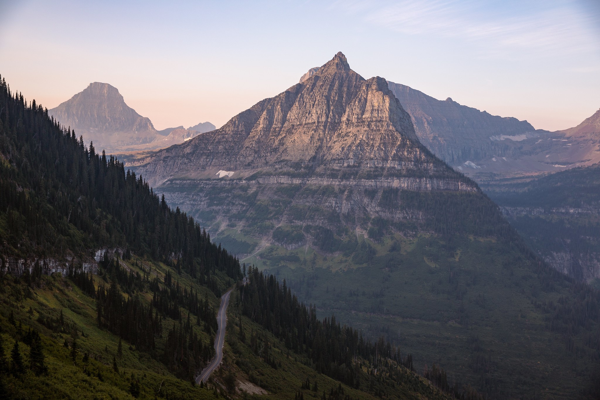
The best easy hikes near West Glacier still give you the things you came for: cold, clear water, cedar forest, mountain views, and the feeling that the everyday world has gone quiet for a while.
You do not need to complete an all-day summit or climb thousands of feet to have a real Glacier day.
Some of the most memorable West Side trails are short enough to pair with a scenic drive, a lake afternoon, or a slower morning. The key is choosing a trail that works for your group, your energy level, and the conditions that day.
This guide compares six easy and moderate hikes near West Glacier, Lake McDonald, and Going-to-the-Sun Road.
WHAT DOES “EASY” MEAN IN GLACIER NATIONAL PARK?
Trail difficulty is personal.
Mileage is only one part of the experience. Elevation gain, altitude, stairs, sun exposure, slippery surfaces, lingering snow, heat, and wildlife activity all affect how a hike feels.
A one-mile trail can feel challenging with tired children, limited mobility, or a full day of sightseeing already behind you. A longer trail may feel comfortable when everyone is prepared and conditions are good.
Before choosing a hike, consider:
- Total distance
- Elevation gain
- Trail surface
- Weather exposure
- Available shade
- Current snow or mud
- Parking and transportation
- The youngest or least experienced person in your group
- How much energy everyone has that day
Turn around when the trail stops feeling right. There is no view worth forcing when your group is uncomfortable or conditions are unsafe.
EASY HIKES NEAR WEST GLACIER AT A GLANCE
TRAIL OF THE CEDARS
Distance: 0.9-mile loop
Elevation gain: 83 feet
Best for: Families, mixed-ability groups, and a short forest walk
Good to know: Boardwalk through an old-growth cedar and hemlock forest
ROCKY POINT
Distance: 0.7-mile loop
Elevation gain: 224 feet
Best for: Lake McDonald views and beach access
Good to know: Natural trail surfaces may include roots, rocks, and uneven areas
OXBOW TRAIL
Distance: Approximately 1.1 miles
Best for: Birds, wetlands, and a quieter walk
Good to know: The trail follows woods and wetlands near Lower McDonald Creek
JOHNS LAKE LOOP
Distance: Approximately 2 miles
Best for: A longer forest walk without a major climb
Good to know: Shaded cedar and hemlock forest with a small lake
HIDDEN LAKE OVERLOOK
Distance: 2.6 miles round trip
Elevation gain: 608 feet
Best for: High-country scenery
Good to know: Includes boardwalk, stairs, switchbacks, and exposed alpine conditions
AVALANCHE LAKE
Distance: Approximately 4.6 miles round trip from Trail of the Cedars
Elevation gain: 741 feet
Best for: A longer hike to a mountain lake
Good to know: Popular trail with limited parking and a steady forest climb
Trail information comes from the National Park Service. Always check current road, trail, and wildlife conditions before leaving.
SHORT AND EASY HIKES NEAR WEST GLACIER
These West Side walks are good starting points for families, beginners, and visitors who want to experience Glacier without committing most of the day to one trail.
TRAIL OF THE CEDARS
Trail of the Cedars is one of the most approachable hikes near West Glacier.
The 0.9-mile loop follows a wooden boardwalk and paved trail through old-growth western red cedar and hemlock. Along the way, you can listen for birds, look into Avalanche Gorge, and experience a forest that feels more like the Pacific Northwest than the Montana many visitors expect.
The trail gains approximately 83 feet and is listed as wheelchair accessible by the National Park Service.
Trail of the Cedars is a strong choice for:
- Families with younger children
- Visitors with limited hiking experience
- Mixed-ability groups
- A short walk before or after a scenic drive
- Travelers who want shade during warmer weather
- Anyone who wants a meaningful forest experience without a long climb
The trail begins at the Avalanche Picnic Area along Going-to-the-Sun Road.
Parking is limited and the area is also used by hikers traveling to Avalanche Lake. It can become especially busy during peak summer travel.
In 2026, the park shuttle does not serve Trail of the Cedars or Avalanche Lake. You will need a private transportation and parking plan.
If the parking area is full, move on to another activity instead of waiting indefinitely or parking outside a designated space.
Review the official Trail of the Cedars information before your hike.
ROCKY POINT TRAIL
Rocky Point is a 0.7-mile loop near Fish Creek Campground on the western side of Lake McDonald.
The trail travels through forest and part of the area affected by the 2003 Roberts Fire. It leads toward views of Lake McDonald and includes access to the shoreline.
The National Park Service lists approximately 224 feet of elevation gain. While the trail is short, the natural surface can include roots, rocks, and uneven ground.
Rocky Point works well when you want:
- Lake McDonald views without a long hike
- A short trail away from the busiest areas of Apgar
- Beach or shoreline access
- A walk that can fit into an arrival or departure day
- A trail with a little more movement than a flat boardwalk
Conditions near the water can change quickly. Use care around wet rocks, steep edges, and cold water.
Check the official Rocky Point Trail information before visiting.
OXBOW TRAIL
Oxbow Trail follows woods and wetlands near Lower McDonald Creek.
The National Park Service describes it as an approximately 1.1-mile hike and highlights the area as a place to look for birds, beavers, and other wildlife.
Bring binoculars and give the area time. This is not a trail that needs to be rushed. Walk quietly enough to notice movement in the wetlands while still making your presence known in bear country.
Oxbow Trail is a good option for:
- Birdwatching
- Families who enjoy looking for wildlife signs
- A quieter morning near Apgar
- Visitors who prefer forest and wetland scenery
- A shorter walk that does not require reaching Logan Pass
Wetland areas can be muddy or buggy depending on the season. Pack insect protection and shoes that can handle damp trail conditions.
JOHNS LAKE LOOP
Johns Lake Loop travels through the shaded cedar and hemlock forest of the Lake McDonald Valley.
The National Park Service’s family guide describes it as a two-mile loop that passes a small lake. The trail offers more time in the forest without the sustained climb of Avalanche Lake or the exposed conditions found at Logan Pass.
Johns Lake Loop may be a good fit if you want:
- A longer walk without a major elevation gain
- Shaded forest
- A quieter alternative to the busiest West Side trails
- A flexible morning or afternoon activity
- A trail that feels grounded in the western side of Glacier
Roots and trail surfaces can become slick after rain. Take your time and choose footwear with dependable traction.
The current Glacier family activity guide includes Johns Lake Loop and other family-friendly West Side walks.
MODERATE WEST GLACIER HIKES WORTH THE EFFORT
These trails are still manageable for many visitors, but they require more time, preparation, and energy than the shorter walks.
Do not choose a moderate hike based on mileage alone. Consider elevation, altitude, weather exposure, parking, and the ability of everyone in your group.
HIDDEN LAKE OVERLOOK
Hidden Lake Overlook begins behind the Logan Pass Visitor Center.
The trail travels approximately 1.3 miles each way and gains 608 feet. The surface includes wooden boardwalk, packed trail, stairs, and switchbacks.
The route opens into high-country scenery with mountain views, alpine plants, and frequent wildlife activity. Snow can remain on the trail well into the summer, and weather can change quickly at Logan Pass.
Hidden Lake Overlook may work well for:
- Visitors who want an alpine hiking experience
- Families with older children who are comfortable with stairs
- Couples looking for a moderate scenic hike
- Travelers with a three-hour Logan Pass parking window
- Visitors arriving on the ticketed Logan Pass Shuttle
The distance is approachable for many hikers, but the elevation and exposure deserve respect. Bring water, sun protection, layers, and a clear turnaround time.
Mountain goats, bighorn sheep, bears, and other wildlife may be present. Keep at least 100 yards from bears and wolves and 25 yards from all other wildlife.
From July 1 through September 7, 2026, private vehicle parking at Logan Pass is limited to three hours. Parking remains first-come, first-served and is not guaranteed.
Visitors planning to spend more time at Logan Pass should review the ticketed shuttle options before arriving.
Check the official Hidden Lake Trail information and 2026 Logan Pass guidance before your hike.
AVALANCHE LAKE
Avalanche Lake is one of the most popular hikes on the western side of Glacier National Park.
The trail begins from Trail of the Cedars and continues approximately 2.3 miles each way. The route gains 741 feet as it climbs steadily through old-growth forest toward Avalanche Lake.
At the lake, mountains rise around the water while long waterfalls descend from the surrounding cliffs.
Avalanche Lake is a good choice for:
- Visitors ready for a half-day hike
- Families with older children who are comfortable walking several miles
- Couples who want a longer trail with a clear destination
- Hikers who prefer forest shade to exposed alpine terrain
- Travelers who want lake and waterfall views
The trail is popular, and parking is limited. In 2026, the park shuttle does not serve the Avalanche Lake trailhead.
Make an alternate plan before leaving. If you cannot park safely in a designated area, choose another trail rather than letting one crowded trail take over the day.
The total hiking distance will be longer when you include the portion of Trail of the Cedars used to reach the Avalanche Lake junction.
Review the official Avalanche Lake Trail information before your hike.
WHICH WEST GLACIER HIKE SHOULD YOU CHOOSE?
The best trail depends on what you want from the day.
BEST FOR A SHORT FOREST WALK
Choose Trail of the Cedars.
The boardwalk, old-growth forest, and low elevation gain create a meaningful walk without requiring a long hiking day.
BEST FOR LAKE MCDONALD VIEWS
Choose Rocky Point.
The trail combines forest, shoreline access, and lake views in a short loop.
BEST FOR BIRDS AND WETLANDS
Choose Oxbow Trail.
Bring binoculars and leave enough time to watch the landscape rather than moving through it quickly.
BEST FOR A QUIET FOREST LOOP
Choose Johns Lake Loop.
The longer distance gives you more time among the trees without requiring a major climb.
BEST FOR HIGH-COUNTRY SCENERY
Choose Hidden Lake Overlook when Logan Pass access, weather, and trail conditions cooperate.
The elevation and exposed terrain make it more challenging than the shorter West Side walks.
BEST FOR A LONGER LAKE DESTINATION
Choose Avalanche Lake.
Plan for a half-day, bring enough food and water, and have a backup plan for parking.
HOW TO PLAN A FAMILY-FRIENDLY GLACIER HIKE
A family hike does not need to be long to count.
Choose a trail based on the youngest or least experienced person in the group. Give children a job, such as looking for a certain bird, spotting animal tracks, or choosing the next snack stop.
Before leaving:
- Use the bathroom
- Fill every water bottle
- Pack more snacks than you think you need
- Apply sun and insect protection
- Bring extra layers
- Set an easy turnaround time
- Explain wildlife rules
- Keep children close on the trail
- Avoid planning another major activity immediately afterward
If the kids are done, the hike is done. Turning around before everyone becomes miserable protects the rest of the day.
Our Glacier National Park with kids guide includes more family trip-planning advice.
WHAT TO BRING ON AN EASY GLACIER HIKE
Even a short trail requires basic preparation.
Bring:
- Water
- Snacks
- Weather-appropriate layers
- Rain protection
- Sun protection
- Insect protection
- A basic first aid kit
- A trail map
- A charged phone
- A portable light
- Bear spray
- Supportive shoes
Download maps before entering the park because cell service can be unreliable.
Do not drink untreated water from lakes, rivers, or streams. Natural water should be filtered, boiled, or properly treated before drinking.
BEAR AND WILDLIFE SAFETY ON SHORT HIKES
Bear activity is not limited to remote or difficult trails.
Carry bear spray where it is immediately accessible, not buried inside your backpack. Know how to remove the safety mechanism and use the spray before beginning your hike.
Bear spray is not a preventive repellent. Never spray it on clothing, people, tents, or gear.
Make your presence known by talking and calling out, especially near running water, thick vegetation, blind corners, and other areas where wildlife may not hear you approaching.
If you encounter a bear:
- Do not run
- Stay calm
- Keep your group together
- Move away slowly when possible
- Give the bear space and a clear path
- Follow current National Park Service guidance
Visitors must remain at least 100 yards from bears and wolves and at least 25 yards from other wildlife.
Read Glacier National Park’s complete bear safety guidance before your trip.
CHECK CONDITIONS BEFORE LEAVING
Trail access can change because of snow, weather, wildlife activity, construction, fire, flooding, or other hazards.
Check Glacier National Park’s current conditions on the morning of your hike.
A trail being listed in this guide does not mean it will be accessible or appropriate on the day of your visit.
Ask a ranger if you are unsure. Choose another trail when conditions are not right.
Glacier gives you plenty of ways to have a good day without forcing the original plan.
AFTER THE HIKE
A good trail day does not need a complicated ending.
Come back to your cabin, take a hot shower, start a load of trail clothes, and make something simple in the kitchen.
The shared firepit, horseshoes, and cornhole are there if everyone still has energy. A comfortable bed is there if they do not.
The hike may be the reason you came, but the slower hours afterward are often when everyone finally has time to talk about it.
FREQUENTLY ASKED QUESTIONS ABOUT EASY HIKES NEAR WEST GLACIER
What is the easiest hike near West Glacier?
Trail of the Cedars is one of the most accessible options. It is a 0.9-mile loop with approximately 83 feet of elevation gain and a boardwalk through an old-growth forest.
Parking and trail access still require planning.
Which Glacier hikes are good for beginners?
Trail of the Cedars, Oxbow Trail, Rocky Point, and Johns Lake Loop are useful starting points.
Compare distance, elevation, surface, weather exposure, and current conditions before choosing a trail.
What is the best short hike near Lake McDonald?
Rocky Point is a strong choice for visitors who want a short trail with Lake McDonald views and shoreline access.
Trail of the Cedars is another good option if forest and creek scenery are more important to you.
Is Trail of the Cedars wheelchair accessible?
Yes. The National Park Service lists Trail of the Cedars as wheelchair accessible.
Current surface conditions, maintenance, snow, and weather may affect access, so check with a ranger if you have specific concerns.
Is Trail of the Cedars stroller-friendly?
The boardwalk and accessible trail surface may work for many strollers.
Stroller suitability depends on the stroller, current conditions, and which portion of the loop you plan to use. Check with a ranger when you arrive if you have concerns.
Is Hidden Lake Overlook an easy hike?
Hidden Lake Overlook is moderate rather than truly easy.
The 2.6-mile round trip includes 608 feet of elevation gain, stairs, switchbacks, boardwalk, altitude, and exposed high-country conditions.
Is Avalanche Lake an easy hike?
Avalanche Lake is generally considered a moderate hike.
The trail climbs steadily for approximately 2.3 miles each way after leaving Trail of the Cedars. Plan for several hours and bring enough water, food, and layers.
Do I need bear spray on a short hike?
Bear activity is not limited to long or remote trails.
Carry bear spray where it is immediately accessible and know how to use it. Follow all National Park Service bear and wildlife guidance.
Are dogs allowed on Glacier National Park hiking trails?
Pets are generally not permitted on hiking trails in Glacier National Park. Limited exceptions apply in certain developed areas and on designated bike paths.
Review the park’s current pet rules before bringing an animal.
Where can I check Glacier trail closures?
Use Glacier National Park’s current conditions and trail status pages immediately before leaving.
You can also ask a ranger at Apgar Visitor Center for updated guidance.
HIKE GLACIER. COME BACK COMFORTABLE.
Keep Glacier National Park’s West Entrance close and give tired legs a cabin, a hot shower, and a good night’s sleep.
Glacier Cabins is located in Martin City, about 15 minutes from the West Entrance under typical driving conditions.